 Loading... Please wait...
Currency Displayed in

- Home
- Maps By Sport
- Canoe Maps Canada
- Yukon River Map - Marsh Lake to Carmacks
Categories
Related Products

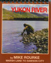

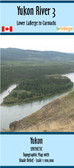
Yukon River Map - Marsh Lake to Carmacks

Hover over image to zoom
)
Product Description
Yukon River - Marsh Lake to Carmacks
This book contains maps, all the historical information and current site information on the 371 kilometer (231 mile) section as far as Carmacks. It includes everything you need to know to paddle, float or motor down the river of gold through such immortal spots as Miles Canyon, Whitehorse, and Lake Laberge.
The maps are at an approximate scale of 1:65,000 and include current and historic site names, details of all river impediments, geographic identifiers, possible campsite locations, and GPS coordinates on every page.
This publication also includes the history of the river, a detailed description of the river itself, suggestions for equipment and a detailed bibliography for further reading for history buffs.