 Loading... Please wait...
Currency Displayed in

- Home
- Maps By Sport
- Hiking Maps
- Whaleback area map
Categories
Related Products
-
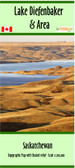 Lake Diefenbaker Map Area $19.95
 -
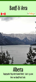 Banff & Area Hiking map $24.95
 -
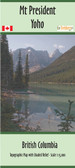 The President and Area map $21.95
 -
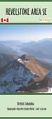 Revelstoke SE Area map $24.95
 -


Whaleback area map

Hover over image to zoom
)
Product Description
Map of Whaleback area, Canada, AB. scale 1:40,000.
Just 1.5hrs south of Calgary, Alberta. The Whaleback area of southwestern Alberta is an essentially roadless region of rare montane landscape. In the southern Whaleback area there are extensive prairies composed of grasses & flowers. Where the soil conditions & aspect combine favourably there are patches of trees that extend fingers of forest into this prairie. As you move from south to north & east to west through the region trees start to predominate & the landscape becomes primarily a forest interspersed with meadows. The diversity of this landscape creates a wide variety of contact points between different plant communities, known as "ecotones" where numerous types of plants & animals can find favourable living conditions. The Whaleback is located at the juncture of 3 major different natural regions. On the northern edge vegetation associated with the foothills predominates. Coming up from the southeast a wide swath of prairie ascends the broad valley of the Oldman River. The western edge of the region is part of the Livingstone Range of the Rocky Mountains. Plants & animals from all three of these regions can find suitable living conditions in the Whaleback montane region.