 Loading... Please wait...
Currency Displayed in

- Home
- Maps By Sport
- Canoe Maps Canada
- Stewart River Map
Categories
Related Products
-
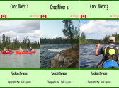 Cree River Map Set $53.95
 -
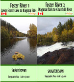 Foster River Map Set $35.95
 -
 Big Salmon River Map $13.95
 -
 South MacMillan River Map $13.95
 -
 Highrock River Map $18.95

Stewart River Map

Hover over image to zoom
)
Product Description
Stewart River - Mayo to Dawson City
The Stewart River is rated as a Class I river (below Fraser Falls) and is suitable for beginner paddlers. This is a river rich in history. The scenery throughout is pleasant and there are ample opportunities to view wildlife. Some of the mammals in the area include beaver, moose, black and grizzly bears, wolves and foxes. The most common fish include chum and chinook salmon, Arctic grayling, round and lake whitefish, burbot, inconnu, northern pike, and lake and rainbow trout. The area is abundant in waterfowl, supports a large variety of songbirds as well as raptors including osprey, eagles, hawks, falcons and owls.
The guide book covers the Stewart River from Fraser Falls to the mouth and then the Yukon River down to Dawson. The trip could be completed in 5 to 8 days depending on how many hours the traveler wants to spend on the river each day. From Mayo to Stewart Crossing would take 1 – 2 days and Stewart Crossing to Dawson City would take 3 – 6 days travel. It is approximately 200 miles from Fraser Falls to the mouth and an additional 70 miles on the Yukon River to Dawson.
The maps are at an approximate scale of 1:65,000 and include current and historic site names, details of all river impediments, geographic identifiers, possible campsite locations, and GPS coordinates on every page. This publication also includes the history of the river (including the Yukon River portion), a detailed description of the river itself, suggestions for equipment and a detailed bibliography for further reading for history buffs.