Loading... Please wait...

Categories

South Africa Travel Map fb

Hover over image to zoom

  • South Africa at 1:1,500,000 from Freytag & Berndt on an indexed road map with on the reverse two large panels showing the Western Cape region at 1:500,000 and the Kruger National Park at 1:400,000, plus street plans of central Johannesburg and Cape Town. The map presents the country’s road and rail network on a base with relief shading, graphics to show the desert areas, marshes, etc., and plenty of names of geographical features. 

Road network clearly shows the numbers of main routes and connecting roads, indicating driving distances. Many local roads and tracks are also included. An overprint highlights the Garden Route. The map includes the rail network and shows local airports. Also marked are internal administrative boundaries with names of the provinces. Large icons highlight numerous places of interest including campsites, nature reserves, historical sites, etc. Latitude and longitude lines are drawn at 1° intervals. The index is on the reverse. Multinational map legend includes English. 

The reverse side has two large panels: the region around Cape Town extending north to St. Helena Bay and eastwards to Cape Agulhas, the southernmost point of Africa, plus Kruger National Park. Both panels are annotated with numerous icons showing various types of tourist accommodation, sport and recreational areas, etc. Also provided are insets with street plans of central Johannesburg and Cape Town.
Freytag
$11.95
SKU:
AK121
Weight:
0.20 KGS

 Product Description

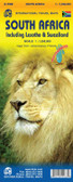
Folded road map of South Africa with National Parks, tourist information & index

South Africa at 1:1,500,000 from Freytag & Berndt on an indexed road map with on the reverse two large panels showing the Western Cape region at 1:500,000 and the Kruger National Park at 1:400,000, plus street plans of central Johannesburg and Cape Town. The map presents the country’s road and rail network on a base with relief shading, graphics to show the desert areas, marshes, etc., and plenty of names of geographical features. 

Road network clearly shows the numbers of main routes and connecting roads, indicating driving distances. Many local roads and tracks are also included. An overprint highlights the Garden Route. The map includes the rail network and shows local airports. Also marked are internal administrative boundaries with names of the provinces. Large icons highlight numerous places of interest including campsites, nature reserves, historical sites, etc. Latitude and longitude lines are drawn at 1° intervals. The index is on the reverse. Multinational map legend includes English. 

The reverse side has two large panels: the region around Cape Town extending north to St. Helena Bay and eastwards to Cape Agulhas, the southernmost point of Africa, plus Kruger National Park. Both panels are annotated with numerous icons showing various types of tourist accommodation, sport and recreational areas, etc. Also provided are insets with street plans of central Johannesburg and Cape Town.

 Find Similar Products by Category

You Recently Viewed...


newsletter

Copyright 2024 GoTrekkers. All Rights Reserved.
 Sitemap | Ecommerce Website Design by High Country Web Design.