 Loading... Please wait...
Currency Displayed in

- Home
- Travel Maps
- Senegal Gambia itmb Travel Map
Categories
Related Products
-
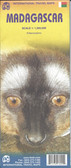 Madagascar itmb Travel Map $13.95
 -
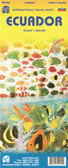 Ecuador itmb Travel Map $12.95
 -
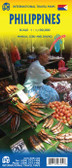 Philippines itmb Travel Map $12.95
 -
 Turkey itmb Travel Map $12.95
 -
 Sumatra Travel Map itmb $13.95

Senegal Gambia itmb Travel Map
, with graphics for mangrove/swamps and salt pans. Within Senegal numeroud national parks and other protected areas are highlighted.
Road network distinguishes between all season and seasonal roads and includes selected tracks. Driving distances are marked on main routes, and the map also indicates locations of petrol supplies and border crossings. Railway lines are included and local airports are marked. The maps also show each country’s internal administrative boundaries with names of the provinces.
Various places of interest are highlighted, many annotated with brief descriptions. The map also indicates locations with tourist accommodation and/or medical facilities. Latitude and longitude lines are drawn at 1° intervals (Senegal/Gambia) and 15’ (Gambia). Each country has a separate index.
The map includes street plans of Dakar, Ile de Gorée and Banjul, showing main streets and indicating locations of various places of interest, including selected hotels. Also provided is a small inset showing precipitation/aridity in that part of Western Africa.")
Hover over image to zoom
)
Product Description
We combined Senegal with Gambia in this edition, but as two completely separate maps - Senegal on one side, and Gambia on the other. During our recent research trip to the two countries, it became obvious to us that the two countries are so inter-linked that it doesn't make sense to show one without the other. This new map has two covers, so the map can be displated Gambia side outwards, or Senegal side outwards. Both maps benefit from improved availability of information, thanks to our visit. Frankly, neither country appears to have progressed significantly over the past 40 years since my first visit, but I'm a cynic. The main east-west highways in both countries are being paved (again) by European countries providing foreign aid (again). No road mainenance camps are being constructed, however. Both countries have created resort communities for oceanside tourism development, which are shown on the map, as well as all road improvement projects we could verify. Both countries are full of smiling people, and are friendly to visitors, but Gambia has police/military check-points every 10 kms or so.
Senegal with Gambia at 1:740,000 with, on the reverse, Gambia itself at a more detailed scale of 1;340,000 on an indexed road map from ITMB with street plans of Dakar, Ile de Gorée and Banjul. Brief annotations accompany various places of interest highlighted in the map.
On one side is Senegal with Gambia at 1:740,000, with on the reverse Gambia shown in greater detail at 1:340,000, with many more settlements and roads or tracks. Topography on both maps is shown by altitude colouring (in metres), with graphics for mangrove/swamps and salt pans. Within Senegal numeroud national parks and other protected areas are highlighted.
Road network distinguishes between all season and seasonal roads and includes selected tracks. Driving distances are marked on main routes, and the map also indicates locations of petrol supplies and border crossings. Railway lines are included and local airports are marked. The maps also show each country’s internal administrative boundaries with names of the provinces.
Various places of interest are highlighted, many annotated with brief descriptions. The map also indicates locations with tourist accommodation and/or medical facilities. Latitude and longitude lines are drawn at 1° intervals (Senegal/Gambia) and 15’ (Gambia). Each country has a separate index.
The map includes street plans of Dakar, Ile de Gorée and Banjul, showing main streets and indicating locations of various places of interest, including selected hotels. Also provided is a small inset showing precipitation/aridity in that part of Western Africa.