 Loading... Please wait...
Currency Displayed in

- Home
- Travel Maps
- Saudi Arabia Kuwait itmb Travel Map
Categories
Related Products
-
 Saudi Arabia Travel Map $11.95
 -
 Madagascar itmb Travel Map $13.95
 -
 Ecuador itmb Travel Map $12.95
 -
 Turkey itmb Travel Map $12.95
 -
 Sumatra Travel Map itmb $13.95

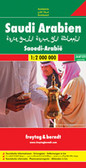
Saudi Arabia Kuwait itmb Travel Map
, with plenty of names of mountain ranges, deserts, etc. The map shows the country’s road network including selected desert tracks, with driving distances marked on main roads. Railway lines are includes and domestic airports are marked. Also shown are locations of selected oil wells and pipelines, boundaries and names of the provinces, and places of interest. The rest of the country is on the reverse. Latitude and longitude lines are drawn at 1° intervals. Each side has a separate index. The map is accompanied by a street plan of central Riyadh, indicating hotels and other facilities.
The side showing the southern part of Saudi Arabia includes a separate panel covering Kuwait at 1:390,00, with latitude and longitude at 30’ and not indexed, plus a street plan of central Kuwait City.
All place names on the maps and the street plans are in the Latin alphabet only.")
Hover over image to zoom
)
Product Description
This is a double-sided map covering the Saudi Peninsula, with the major oil-producing country of Saudi Arabia on one side and the much smaller but also significant oil-producing country of KUwait just to its north. By the shape of the two countries, portions of Qatar, Dubai, Muscat, Iraq, and Yemen necessarily are included, with the same attention to detail. Inset maps of Ruyadh and Kuweit City are included. The peninsulq is not only immensely wealthy, it is the heart of what we call the 'Middle East', vying for religious, political, and economic dominance of the region with Iran and Turkey.
Saudi Arabia presented at 1:1,750,000, indexed, divided between both sides of the map and accompanied by a street plan of central Riyadh, plus as a separate panel Kuwait at 1:390,000 with a street plan of Kuwait City.
On one side is the northern part of Saudi Arabia, extending south to Riyadh and along the Gulf coast to the northernmost tip of the United Arab Emirates. Topography is shown by latitude colouring (bands and peak heights in feet), with plenty of names of mountain ranges, deserts, etc. The map shows the country’s road network including selected desert tracks, with driving distances marked on main roads. Railway lines are includes and domestic airports are marked. Also shown are locations of selected oil wells and pipelines, boundaries and names of the provinces, and places of interest. The rest of the country is on the reverse. Latitude and longitude lines are drawn at 1° intervals. Each side has a separate index. The map is accompanied by a street plan of central Riyadh, indicating hotels and other facilities.
The side showing the southern part of Saudi Arabia includes a separate panel covering Kuwait at 1:390,00, with latitude and longitude at 30’ and not indexed, plus a street plan of central Kuwait City.
All place names on the maps and the street plans are in the Latin alphabet only.