 Loading... Please wait...
Currency Displayed in

- Home
- Travel Maps
- Sahara Travel Map
Categories
Related Products
-
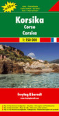 Corsica Travel Map $12.95
 -
 Victoria Map Travel Map $14.95
 -
 New Zealand Map Travel Map $14.95
 -

-
 Bolivia Map Travel Map $12.95

Sahara Travel Map
 and 33ºN elsewhere (Ourgla in Algeria, Tripoli in Libya and Alexandria in Egypt) to approx. 16ºN (Timbuktu in Mali and Agadez in Niger). West / east the map covers the region from the coastline of Western Sahara and Nouakchott in Mauritania to the Abu Simbel temple in Egypt and the bend of the Nile in northern Sudan.
Elevation colouring indicates the topography, with landscape features such as seasonal rivers and lakes, salt flats, and marshes/swamps. Oases and numerous wells/waterholes are also marked, most of them with names. International boundaries are shown with, where appropriate, border crossings. Road network includes selected desert tracks and shows distances on main routes; the map also shows domestic airfields. A range of symbols indicate various places of interest. Latitude and longitude lines are drawn at 5° intervals. Each side has a separate index")
Hover over image to zoom
)
Product Description
ITMB double-sided, folded tourist map of the Sahara at 1:3,850,000 with tourist information, index and small inset map of the Canary Islands on waterproof paper. Great map to buy for travelling in the Sahara Desert, Africa.
The Sahara Desert at 1:3,400,000 on an indexed, double-sided map from ITMB. Coverage extends southwards from approx. 30ºN within Morocco (Agadir) and 33ºN elsewhere (Ourgla in Algeria, Tripoli in Libya and Alexandria in Egypt) to approx. 16ºN (Timbuktu in Mali and Agadez in Niger). West / east the map covers the region from the coastline of Western Sahara and Nouakchott in Mauritania to the Abu Simbel temple in Egypt and the bend of the Nile in northern Sudan.
Elevation colouring indicates the topography, with landscape features such as seasonal rivers and lakes, salt flats, and marshes/swamps. Oases and numerous wells/waterholes are also marked, most of them with names. International boundaries are shown with, where appropriate, border crossings. Road network includes selected desert tracks and shows distances on main routes; the map also shows domestic airfields. A range of symbols indicate various places of interest. Latitude and longitude lines are drawn at 5° intervals. Each side has a separate index