Loading... Please wait...

Categories

Rwanda Burundi itmb Travel Map

Hover over image to zoom

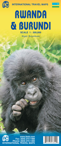
  • Rwanda and Burundi on a double-sided map from ITMB showing each country separately at 1:300,000, indexed and accompanied by a small street plan of its capital, Kigali and Bujumbura annotated with main facilities. The Burundi side of the map extends northwards past Kigali to cover the whole of southern Rwanda 

The maps have elevation colouring with spot heights to show the topography, with graphics for swamps and forested areas. National parks and other protected areas are highlighted. Road network includes local tracks, gives distances on main routes and shows locations of petrol stations and border crossings. Ferry routes are shown on Lake Tanganyika and Lake Kivu and local airports or airfields are marked. Also shown are local administrative boundaries with names of the provinces. 

Symbols highlight various places of interest including selected tourist accommodation, viewpoints, post offices/telephones, medical facilities, etc. Numerous missions and churches are marked throughout both countries. Latitude and longitude lines are drawn at 30' intervals. Each country has a separate index of place names. Map legend is in English and French. 

Two insets show the centres of Kigali and Bujumbura, naming major streets and indicating main facilities, including accommodation and foreign embassies.
ITMB
$13.95
SKU:
IT413820
Weight:
0.20 KGS

 Product Description

Rwanda is the other side of the piece of paper for Burundi and is as different a country as two neighbours could hope to be. The country went through a terrible civil insurrection a few years ago, and the scars of that time will take many more years to heal. The country is lovely to see, with picturesque Kibuye nestled into a cove along beautiful Lake Kivu and town with exotically enticing names such as Gitarama and Butare. This part of Africa is not changing rapidly, so is still relatively unspoiled by modernization. This is the beating heart of Central Africa.

Burundi, in itself, is not an 'important' country in Africa, but its central location makes it crucially important to events in surrounding countries that are much larger, such as Tanzania and Dem Congo. The capital, based at the northern end of Lake Tanganyika, is a sleepy town that offers travellers all the 'mod-cons' - hotels, shops, an airport, several embassies. The countryside is dotted with quaint villages where life carries on much as it has for centuries. This is our fifth edition of Burundi; hard to believe, but that means 25,000 copies so far.

Map size: 27*39” 

Rwanda and Burundi on a double-sided map from ITMB showing each country separately at 1:300,000, indexed and accompanied by a small street plan of its capital, Kigali and Bujumbura annotated with main facilities. The Burundi side of the map extends northwards past Kigali to cover the whole of southern Rwanda 

The maps have elevation colouring with spot heights to show the topography, with graphics for swamps and forested areas. National parks and other protected areas are highlighted. Road network includes local tracks, gives distances on main routes and shows locations of petrol stations and border crossings. Ferry routes are shown on Lake Tanganyika and Lake Kivu and local airports or airfields are marked. Also shown are local administrative boundaries with names of the provinces. 

Symbols highlight various places of interest including selected tourist accommodation, viewpoints, post offices/telephones, medical facilities, etc. Numerous missions and churches are marked throughout both countries. Latitude and longitude lines are drawn at 30' intervals. Each country has a separate index of place names. Map legend is in English and French. 

Two insets show the centres of Kigali and Bujumbura, naming major streets and indicating main facilities, including accommodation and foreign embassies.

 Find Similar Products by Category

You Recently Viewed...


newsletter

Copyright 2024 GoTrekkers. All Rights Reserved.
 Sitemap | Ecommerce Website Design by High Country Web Design.