 Loading... Please wait...
Currency Displayed in

- Home
- Maps By Sport
- Hiking Maps
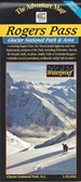
- Glacier National Park - Rogers Pass Map - Summer
Categories
Related Products
-
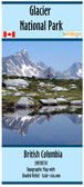
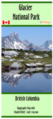 Glacier National Park map $24.95
 -
-
-


Glacier National Park - Rogers Pass Map - Summer
")
Hover over image to zoom
)
Product Description
Folded double-sided topographic map(1:50,000) on waterproof paper covering Rogers Pass & Glacier National Park, British Columbia , Canada by Chrismar with inclusion of Tupper, Avalanche, Illecillewaet, Asulkan & Bonney Glaciers, Hermit, Sir Donald, Asulkan Ranges, and Rogers Pass and facilities. Map covers human and natural history, weather, trail etiquette and safety, and over 150km of hiking, back backing, skiing and interpretive trails. Best travel map buy of the Rogers Pass, Glacier Park area, Canada available.