Loading... Please wait...

Categories

Puerto Rico and US Virgin Islands Travel Map

Hover over image to zoom

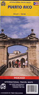
  • Double-sided, waterproof and tear-resistant map from ITMB presenting on one side coverage of Puerto Rico at 1:190,000 accompanied by street plans of San Juan with an enlargement for its Old Town, Mayaguez, Arecibo, Aguadilla and Ponce, plus on the reverse US Virgin Islands at 1:50,000 with plans of Charlotte Amalie with an enlargement of its historic district, Christiansted, Friedensfeld, Frederiksted and Cruz Bay. 

All the islands have their topography presented by altitude colouring, US Virgin islands also have contours at 50m intervals. National parks and other protected areas are highlighted. Road network includes selected local roads and tracks, and on Puerto Rico clearly shows road numbers. Within the US Virgin Islands ferry routes are also marked. Symbols indicate various places of interest. Both the map of Puerto Rico and the two panels with the individual US Virgin Islands: St Thomas with St John, plus St Croix, have latitude and longitude lines. 

The street plan highlight selected accommodation and various places of interest.
ITMB
$9.95
SKU:
IT0065
Weight:
0.20 KGS

 Product Description

ITMB folded road map of Puerto Rico on a scale of 1:190,000 with indexes, tourist information and map insets for San Juan 1:60,000 (12"x7"), Ponce 1:30,000 (8"x6"), Viejo San Juan 1:15,000 (6"x4"), Mayaguez 1:20,000 (5"x6"), Aguadilla 1:22,00 (2"x6"), Arecibo 1:12,000 (5"x3") and Isla Culebra and Isla de Vieques 1:190,000 (4"x7"). Great map to buy if travelling to Puerto Rico.

Double-sided, waterproof and tear-resistant map from ITMB presenting on one side coverage of Puerto Rico at 1:190,000 accompanied by street plans of San Juan with an enlargement for its Old Town, Mayaguez, Arecibo, Aguadilla and Ponce, plus on the reverse US Virgin Islands at 1:50,000 with plans of Charlotte Amalie with an enlargement of its historic district, Christiansted, Friedensfeld, Frederiksted and Cruz Bay. 

All the islands have their topography presented by altitude colouring, US Virgin islands also have contours at 50m intervals. National parks and other protected areas are highlighted. Road network includes selected local roads and tracks, and on Puerto Rico clearly shows road numbers. Within the US Virgin Islands ferry routes are also marked. Symbols indicate various places of interest. Both the map of Puerto Rico and the two panels with the individual US Virgin Islands: St Thomas with St John, plus St Croix, have latitude and longitude lines. 

The street plan highlight selected accommodation and various places of interest.

 Find Similar Products by Category

You Recently Viewed...


newsletter

Copyright 2024 GoTrekkers. All Rights Reserved.
 Sitemap | Ecommerce Website Design by High Country Web Design.