Loading... Please wait...

Categories

Normandy D Day Map

Hover over image to zoom

  • Commemorative map from the IGN for the 70th anniversary of the D-Day landings in Normandy on 6th June 1944, presenting in three large panels various grouping of the Allied Armies and the defending German forces, the changes in the front lines between 6th June and 18th August, and present day commemorative sites and monuments, plus additional bilingual notes. 

The main panel at 1:100,000 shows the five beaches: Utah, Omaha, Gold, Juno and Sword together with the command structure and the disposition of the Allied Forces, from General Eisenhower to individual units including the supporting airborne divisions, and the defending German forces, plus indicates beach heads and the front line 24 hours later. 

A smaller panel at 1:500,000 shows the whole of the Cotintin Peninsula indicating changes in the front line between D-Day and 18th August 1944. Another large panel at 1:250,000 shows north-western Normandy, including Caen and Bayeux, indicating museums, war memorials, military cemeteries and other WWII related information including a suggested tour of the five beaches. Also provided is a map showing the disposition of the armies on both sides of the Channel prior to D-Day, General Eisenhower’s proclamation to the Allied Expeditionary Force, and notes on the Operation Overlord. Map legend and additional text include English. 

PLEASE NOTE: this title is also available as a wall map with the map legend which includes English but with the additional text, apart from General Eisenhower’s proclamation, in French only.
ITMB
$19.95
SKU:
IG110414
Weight:
0.20 KGS

 Product Description

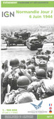
Normandy D Day Map. By IGN of France. 


Normandie Jour J - 6 juin 1944 - 1/100 000. IGN- 2014

Commemorative map from the IGN for the 70th anniversary of the D-Day landings in Normandy on 6th June 1944, presenting in three large panels various grouping of the Allied Armies and the defending German forces, the changes in the front lines between 6th June and 18th August, and present day commemorative sites and monuments, plus additional bilingual notes. 

The main panel at 1:100,000 shows the five beaches: Utah, Omaha, Gold, Juno and Sword together with the command structure and the disposition of the Allied Forces, from General Eisenhower to individual units including the supporting airborne divisions, and the defending German forces, plus indicates beach heads and the front line 24 hours later. 

A smaller panel at 1:500,000 shows the whole of the Cotintin Peninsula indicating changes in the front line between D-Day and 18th August 1944. Another large panel at 1:250,000 shows north-western Normandy, including Caen and Bayeux, indicating museums, war memorials, military cemeteries and other WWII related information including a suggested tour of the five beaches. Also provided is a map showing the disposition of the armies on both sides of the Channel prior to D-Day, General Eisenhower’s proclamation to the Allied Expeditionary Force, and notes on the Operation Overlord. Map legend and additional text include English. 

PLEASE NOTE: this title is also available as a wall map with the map legend which includes English but with the additional text, apart from General Eisenhower’s proclamation, in French only.

 Find Similar Products by Category

You Recently Viewed...


newsletter

Copyright 2024 GoTrekkers. All Rights Reserved.
 Sitemap | Ecommerce Website Design by High Country Web Design.