 Loading... Please wait...
Currency Displayed in

- Home
- Maps By Sport
- Canoe Maps Canada
- Nisutlin River Map
Categories
Related Products
-
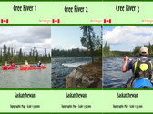 Cree River Map Set $53.95
 -
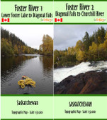 Foster River Map Set $35.95
 -
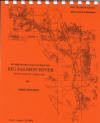 Big Salmon River Map $13.95
 -
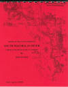 South MacMillan River Map $13.95
 -
 Highrock River Map $18.95

Nisutlin River Map

Hover over image to zoom
)
Product Description
Nisutlin River - Rose River to Teslin
One of the least traveled rivers within relatively easy reach of Whitehorse, the Nisutlin has gained popularity as a wilderness river in recent years. The stretch from Rose River to the camp ground at Mile 43 on the South Canol Road will require basic maneuvering skills and extra caution, especially at lower water levels due to river obstacles such as rocks, sweepers, etc. The remainder of the river can be run by beginners using common sense. One must remember that the river enters into the relatively large Teslin Lake which is subject to winds and high waves. Not a particularly large or long river, the Nisutlin seldom reveals signs of man and usually presents a wide assortment of animal life. The fishing is good and its somewhat slower current allows one to relax and soak in the outdoors for about a week.
The maps are at an approximate scale of 1:65,000 and include current and historic site names, details of all river impediments, geographic identifiers, and possible campsite locations. This publication also includes the history of the river, a detailed description of the river itself, suggestions for equipment and a list of suggestions for 'no trace camping'.