Loading... Please wait...

Categories

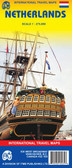
Netherlands Travel Map

Hover over image to zoom

  • Detailed road map of the Netherlands, with index and city centre street enlargements of Amsterdam and the Hague. Clearly shows the national road network and selected provincial and local roads, with each class of road clearly indicated and road numbers shown. Intermediate driving distances between locations are shown in kilometres alongside the road, motorway filling stations are shown and motorway junctions are indicated.

Colour shading is used to indicate land types such as forests or marshland. International and provincial boundaries are clearly marked, as are nature reserves and restricted military areas.

Symbols indicate various sights & locations of tourist interest, such as churches, leisure & sports destinations, panoramas & viewing points, monuments and historic sites. Some hotels and campsites are marked. Railway lines, airports, ports and marinas are also shown.

A grid divides the map at 30’ increments, and is also grid-referenced for the accompanying index booklet.

*Multilingual map legend includes English.*
Freytag
$11.95
SKU:
AK8001
Weight:
0.20 KGS

 Product Description

Freytag folded road and leisure map of the Netherlands at 1:300,000 with city maps for Amsterdam and s'Gravenhagen, tourist information, and index with postal codes. Best quality travel map that you can buy for your trip to the Netherlands.

Detailed road map of the Netherlands, with index and city centre street enlargements of Amsterdam and the Hague. Clearly shows the national road network and selected provincial and local roads, with each class of road clearly indicated and road numbers shown. Intermediate driving distances between locations are shown in kilometres alongside the road, motorway filling stations are shown and motorway junctions are indicated.

Colour shading is used to indicate land types such as forests or marshland. International and provincial boundaries are clearly marked, as are nature reserves and restricted military areas.

Symbols indicate various sights & locations of tourist interest, such as churches, leisure & sports destinations, panoramas & viewing points, monuments and historic sites. Some hotels and campsites are marked. Railway lines, airports, ports and marinas are also shown.

A grid divides the map at 30’ increments, and is also grid-referenced for the accompanying index booklet.

*Multilingual map legend includes English.*

 Find Similar Products by Category

You Recently Viewed...


newsletter

Copyright 2024 GoTrekkers. All Rights Reserved.
 Sitemap | Ecommerce Website Design by High Country Web Design.