Loading... Please wait...

Categories

Morocco itmb Travel Map

Hover over image to zoom

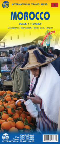
  • Morocco at 1:1,200,000 on a waterproof and tear-resistant map from ITMB, with large, clear street plans of central Tangier, Rabat – Salé, Marrakesh and Casablanca. The map is double-sided and presents the whole of Morocco itself on one side, with the Western Sahara on the reverse at the same scale. 

Topography is shown by altitude colouring and spot heights, both in feet, with names of various mountain ranges, valleys, etc. Road network includes selected local tracks, indicates distance on main routes and shows locations of petrol supplies. Railway lines are included and domestic airports are marked. A range of symbols indicate various places of interest, including campsites, forts, mosques, parks and reserves, beaches, etc. Latitude and longitude lines are drawn at 1° intervals. Each side has a separate index. 

The four street plans highlight selected hotels, various facilities and places of interest. Additional notes provide a geographical and historical overview of the country.
ITMB
$12.95
SKU:
IT294638
Weight:
0.20 KGS

 Product Description

One of the most stable and attractive Arabic countries for visitors is Morocco. The sea crossing from Spain is short, and travel facilities for visitors arriving by air are modern. We have updated our map to show the latest road improvements and have prepared insets of Casablanca, Marrakesh, Rabat/Sale, and Tangier. We have visited Morocco three times in recent years and have always found the people to be hospitable, the accommodations satisfactory, the food excellent, and the scenery superlative. We have printed the map on durable ITM plastic paper.

Morocco at 1:1,200,000 on a waterproof and tear-resistant map from ITMB, with large, clear street plans of central Tangier, Rabat – Salé, Marrakesh and Casablanca. The map is double-sided and presents the whole of Morocco itself on one side, with the Western Sahara on the reverse at the same scale. 

Topography is shown by altitude colouring and spot heights, both in feet, with names of various mountain ranges, valleys, etc. Road network includes selected local tracks, indicates distance on main routes and shows locations of petrol supplies. Railway lines are included and domestic airports are marked. A range of symbols indicate various places of interest, including campsites, forts, mosques, parks and reserves, beaches, etc. Latitude and longitude lines are drawn at 1° intervals. Each side has a separate index. 

The four street plans highlight selected hotels, various facilities and places of interest. Additional notes provide a geographical and historical overview of the country.

 Find Similar Products by Category

You Recently Viewed...


newsletter

Copyright 2024 GoTrekkers. All Rights Reserved.
 Sitemap | Ecommerce Website Design by High Country Web Design.