Loading... Please wait...

Categories

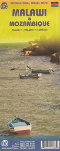
Malawi and Mozambique Travel Map

Hover over image to zoom

  • Malawi at 1:900,000 and Mozambique at 1:1,900,000 from ITMB, with each country shown separately on one side of the map, indexed and accompanied by street plans of its two main cities: Blantyre and Lilongwe, plus Maputo and Beira. 

Bold altitude colouring shows the topography, with elevation in Malawi in metres and in Mozambique in feet. Swamps, marshes, wetlands and seasonal rivers are marked. National parks and protected areas are highlighted. The maps show each country’s road and rail networks, with a range of symbols indicating various places of interest and tourist facilities. Each map is indexed and has latitude and longitude lines at 1° and/or 2°. 

Large, clear street plans show the central areas in each country’s two main cities, Blantyre and Lilongwe, plus Maputo and Beira, annotated with places of interest and selected accommodation. The Malawi map also includes additional notes of the country’s history, climate, national parks, etc.
ITMB
$12.95
SKU:
IT13080
Weight:
0.20 KGS

 Product Description

Malawi at 1:900,000 and Mozambique at 1:1,900,000 from ITMB, with each country shown separately on one side of the map, indexed and accompanied by street plans of its two main cities: Blantyre and Lilongwe, plus Maputo and Beira. 

Bold altitude colouring shows the topography, with elevation in Malawi in metres and in Mozambique in feet. Swamps, marshes, wetlands and seasonal rivers are marked. National parks and protected areas are highlighted. The maps show each country’s road and rail networks, with a range of symbols indicating various places of interest and tourist facilities. Each map is indexed and has latitude and longitude lines at 1° and/or 2°. 

Large, clear street plans show the central areas in each country’s two main cities, Blantyre and Lilongwe, plus Maputo and Beira, annotated with places of interest and selected accommodation. The Malawi map also includes additional notes of the country’s history, climate, national parks, etc.

 Find Similar Products by Category

You Recently Viewed...


newsletter

Copyright 2024 GoTrekkers. All Rights Reserved.
 Sitemap | Ecommerce Website Design by High Country Web Design.