Loading... Please wait...

Categories

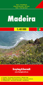
Madeira Walking Travel Map

Hover over image to zoom

  • Madeira on a double-sided, indexed, hiking map from Freytag & Berndt at 1:30,000 with prominent highlighting for walking routes, scenic roads, picturesque locations and places of interest, plus a street plan of central Funchal and a booklet with general notes about the island and brief descriptions of seven recommended hiking routes. Place names and road numbers are in larger size font than found on other maps of the island. 

Topography is presented by contours enhanced by relief shading, with numerous spot heights and names of geographical features. Boldly presented road network includes local roads or tracks, gives distances on main routes, and shows gradients on steep sections. Scenic routes are prominently marked. Hiking trails are also highlighted and where appropriate annotated with their official waymarking route numbers. The map indicates picturesque towns and villages; a wide range of other icons mark various places of interest. 

A separate inset at 1:40,000 shows Porto Santo with similar presentation. For GPS, the map has a UTM grid, plus latitude and longitude margin ticks and crosshairs at intervals of 2’. The booklet provides an index which also gives for each location its GPS waypoints. Also provided is a street plan showing main sights in Funchal. Map legend and the text in the booklet include English. 

Please note: the same map is also published by Freytag & Berndt at 1:40,000, presenting the whole island on one side. Accompanying multilingual booklet has descriptions of best sights.
Freytag
$13.95
SKU:
WKP1
Weight:
0.20 KGS

 Product Description

Madeira on a double-sided, indexed, hiking map from Freytag & Berndt at 1:30,000 with prominent highlighting for walking routes, scenic roads, picturesque locations and places of interest, plus a street plan of central Funchal and a booklet with general notes about the island and brief descriptions of seven recommended hiking routes. Place names and road numbers are in larger size font than found on other maps of the island. 

Topography is presented by contours enhanced by relief shading, with numerous spot heights and names of geographical features. Boldly presented road network includes local roads or tracks, gives distances on main routes, and shows gradients on steep sections. Scenic routes are prominently marked. Hiking trails are also highlighted and where appropriate annotated with their official waymarking route numbers. The map indicates picturesque towns and villages; a wide range of other icons mark various places of interest. 

A separate inset at 1:40,000 shows Porto Santo with similar presentation. For GPS, the map has a UTM grid, plus latitude and longitude margin ticks and crosshairs at intervals of 2’. The booklet provides an index which also gives for each location its GPS waypoints. Also provided is a street plan showing main sights in Funchal. Map legend and the text in the booklet include English. 

Please note: the same map is also published by Freytag & Berndt at 1:40,000, presenting the whole island on one side. Accompanying multilingual booklet has descriptions of best sights.

 Find Similar Products by Category

You Recently Viewed...


newsletter

Copyright 2024 GoTrekkers. All Rights Reserved.
 Sitemap | Ecommerce Website Design by High Country Web Design.