Loading... Please wait...

Categories

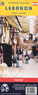
Lebanon and Beirut Travel Map

Hover over image to zoom

  • Lebanon on an indexed road map at 1:190,000 from ITMB, plus on the reverse an indexed street plan of Beirut at 1: 8,300; also included are historical notes on the country’s civil war from 1975 to 1991. All place names on the road map and the plan are in Latin alphabet only. 

The map shows Lebanon’s road and rail networks on a base with the topography indicated by altitude colouring, plus graphics for deserts, swamps, etc. Symbols mark various places of interest including selected hotels and campsites, historical and cultural sites, beaches, etc. The map also shows the course of the historic Silk Road from Beirut to Damascus or to Baalbek and northwards towards the northern border with Syria. Latitude and longitude lines are drawn at 15’ interval. The map is indexed and surrounded by notes about the country’s main historical sites. 

On the reverse is a clear, indexed street plan of Beirut at 1:8,300, extending south to include part of the infamous Shatila Palestinian Refugee Camp. Symbols indicate locations of selected hotels and restaurants, shopping centres, petrol stations, cultural institutions, etc.
ITMB
$13.95
SKU:
IT0048
Weight:
0.20 KGS

 Product Description

ITMB folded colour map of Lebanon on a scale of 1:200,000 with index and inset map of the city of Beirut (6”x10”) on a scale of 1:22,500. Best travel and road map to buy for Lebanon.

Lebanon on an indexed road map at 1:190,000 from ITMB, plus on the reverse an indexed street plan of Beirut at 1: 8,300; also included are historical notes on the country’s civil war from 1975 to 1991. All place names on the road map and the plan are in Latin alphabet only. 

The map shows Lebanon’s road and rail networks on a base with the topography indicated by altitude colouring, plus graphics for deserts, swamps, etc. Symbols mark various places of interest including selected hotels and campsites, historical and cultural sites, beaches, etc. The map also shows the course of the historic Silk Road from Beirut to Damascus or to Baalbek and northwards towards the northern border with Syria. Latitude and longitude lines are drawn at 15’ interval. The map is indexed and surrounded by notes about the country’s main historical sites. 

On the reverse is a clear, indexed street plan of Beirut at 1:8,300, extending south to include part of the infamous Shatila Palestinian Refugee Camp. Symbols indicate locations of selected hotels and restaurants, shopping centres, petrol stations, cultural institutions, etc.

 Find Similar Products by Category

You Recently Viewed...


newsletter

Copyright 2024 GoTrekkers. All Rights Reserved.
 Sitemap | Ecommerce Website Design by High Country Web Design.