Loading... Please wait...

Categories

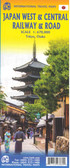
Kyoto and Japan West Travel Map

Hover over image to zoom

  • Kyoto on a detailed street plan at 1:12,500 from ITMB, with a road map of the Kyoto - Osaka - Nara area, plus a street plan of central Nara and, on the reverse, an indexed road map of western Japan at 1:670,000 and a street plan of central Osaka. 

On one side is a street plan of Kyoto highlighting places of interest including selected hotels, department stores, temples and shrines, etc. Metro stations show locations of individual entrances/exits. Main traffic routes are highlighted and one way streets are marked. As is normal on street plans of Japanese cities, only main streets are named and the plan shows names of districts and zones. The index lists streets, districts, zones, and temples/shrines. The plan is accompanied by a road map of the Kyoto - Osaka - Nara area. 

On the reverse is an indexed road map of central Japan at 1:670,000 extending from Tokyo westwards to Matsuyama on north-eastern Shikoku. The map shows the region’s road and rail networks and indicates various places of interest. An inset presents a street plan of central Osaka.
ITMB
$12.95
SKU:
IT294096
Weight:
0.20 KGS

 Product Description

 Kyoto & Japan West map scale 1;12,500 & 1:670,000 with inserts for Osaka Nara

Kyoto on a detailed street plan at 1:12,500 from ITMB, with a road map of the Kyoto - Osaka - Nara area, plus a street plan of central Nara and, on the reverse, an indexed road map of western Japan at 1:670,000 and a street plan of central Osaka. 

On one side is a street plan of Kyoto highlighting places of interest including selected hotels, department stores, temples and shrines, etc. Metro stations show locations of individual entrances/exits. Main traffic routes are highlighted and one way streets are marked. As is normal on street plans of Japanese cities, only main streets are named and the plan shows names of districts and zones. The index lists streets, districts, zones, and temples/shrines. The plan is accompanied by a road map of the Kyoto - Osaka - Nara area. 

On the reverse is an indexed road map of central Japan at 1:670,000 extending from Tokyo westwards to Matsuyama on north-eastern Shikoku. The map shows the region’s road and rail networks and indicates various places of interest. An inset presents a street plan of central Osaka.

 Find Similar Products by Category

You Recently Viewed...


newsletter

Copyright 2024 GoTrekkers. All Rights Reserved.
 Sitemap | Ecommerce Website Design by High Country Web Design.