 Loading... Please wait...
Currency Displayed in

- Home
- Travel Maps
- Kosovo Travel Map
Categories
Related Products
-
 Victoria Map Travel Map $14.95
 -
 New Zealand Map Travel Map $14.95
 -

-
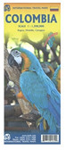 Columbia Travel Map $12.95
 -
 Bolivia Map Travel Map $12.95

Kosovo Travel Map
.
The map is an enlargement of F&B’s mapping of the region at a smaller scale, so all names are in much larger print size than found on similar maps. Topography is presented by relief shading with colouring for forested areas, plus names of various mountain ranges and peaks. Road network includes small local roads and selected cart tracks. Driving distances are marked on main routes and scenic roads are highlighted. Railway lines are shown with stations. Various places of interest, including the publishers’ recommendations are highlighted. Latitude and longitude lines are drawn at 10’ intervals. Multilingual map legend includes English.
The index, arranged by country, is in a separate booklet attached to the map cover and, where appropriate, shows locations with their postcodes. The booklet also includes a street plan of central Prishtina, plus publishers’ recommendations of Kosovo’s 10 top sights, each with a multilingual brief description.")
Hover over image to zoom
)
Product Description
Freytag map of Kosovo at scale 1:150,000 showing top 10 sights, top city maps, distances in km
Kosovo at 1:150,000 on a large map in Freytag & Berndt’s “Top 10 Tips” series with the index booklet also providing multilingual descriptions of the country’s most interesting locations. Where appropriate, place names are bilingual, with Serbian names shown in Latin alphabet only (within Serbia itself and Macedonia place names are in both Cyrillic and Latin alphabets).
The map is an enlargement of F&B’s mapping of the region at a smaller scale, so all names are in much larger print size than found on similar maps. Topography is presented by relief shading with colouring for forested areas, plus names of various mountain ranges and peaks. Road network includes small local roads and selected cart tracks. Driving distances are marked on main routes and scenic roads are highlighted. Railway lines are shown with stations. Various places of interest, including the publishers’ recommendations are highlighted. Latitude and longitude lines are drawn at 10’ intervals. Multilingual map legend includes English.
The index, arranged by country, is in a separate booklet attached to the map cover and, where appropriate, shows locations with their postcodes. The booklet also includes a street plan of central Prishtina, plus publishers’ recommendations of Kosovo’s 10 top sights, each with a multilingual brief description.