 Loading... Please wait...
Currency Displayed in

- Home
- Maps By Sport
- Biking Maps
- Iron Curtain Bicycle Trail 2 Cycline Mapbook
Categories
Related Products


Iron Curtain Bicycle Trail 2 Cycline Mapbook

Hover over image to zoom
)
Product Description
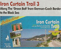
The Iron Curtain Trail Part 2 from 2012: Along the Green Belt from Usedom via the German German border Trail to the Czech border. Discovering history on the road, that is the goal of the Iron Curtain Trail. From the Barents Sea down to the Black Sea, the traces of the Cold War can be found across Europe. The route does not just combine European culture, history & sustainable tourism but also takes the history-loving cyclist through very diverse landscapes & through the unique biotopes of the European Green Belt, which could develop in the border strip. The 2nd volume documents almost 1,600km of the route, which goes from Swinemunds (Swinoujscie) on the German Polish border to Prex on the 3 country border of Saxony-Bavaria-Czech Republic. Maps, route descriptions, extensive historical background information, information about the cultural & touristic offers in every region as well as practical travel & accommodation tips make this cycle guide a valuable companion on the discovery tour along the former Iron Curtain.
German History after 1945
The history of the German-German border does not begin with the building of the Wall on 13 August 1961, but with Hitler seizing power on 30 January 1933, and with the beginning of the Second World War on 1 September 1939, as the German Army marched into Poland. Had Nazi-Germany not started the Second World War, Germany would not have been occupied or divided.<br< already="" during="" the="" war,="" allies="" decided="" that="" they="" would="" divide="" germany="" into="" zones="" of="" occupation="" after="" its="" defeat,="" which="" were="" to="" be="" administered="" by="" three="" victorious="" powers,="" usa,="" great="" britain="" and="" soviet="" union="" –="" france="" was="" added="" this="" group="" at="" yalta="" conference="" in="" february="" 1945.="" despite="" their="" different="" ideologies="" anti-hitler="" coalition="" united="" fight="" against="" nazi-germany.="" however,="" changed="" soon="" unconditional="" surrender="" german="" army.<br="">At the Potsdam Conference on 2 August 1945, the victorious powers agreed to treat Germany as an economic unit and to rule it without regard to the zones and sectors into which it had been divided. Germany – also the former capital Berlin – was divided into American, British, French and Soviet zones. The borders were to be treated as administrative lines and were called “demarcation lines”. However, with the former Allies increasingly drifting apart, the character of the demarcation line changed between the three Western zones on the one side and the Eastern zone on the other.
Winston Churchill, who failed to get elected again as British Prime Minister after the war, had already stated in his famous speech in Fulton, Missouri, on 5 March 1946, that a part of Europe had disappeared behind an “Iron Curtain” and that Europe was divided. The Cold War had begun.
From 1947 the Soviets reinforced the development of the zonal border by erecting road blocks and barbed-wire obstacles at various points. At the same time the differences in the economies became apparent: In the Soviet zone of occupation certain reforms were instituted: there was a reform of land ownership, companies were nationalised, reparations were obtained and the German Communist Party (KPD) was forcibly united with the Social Democrats (SPD) to form the Socialist Unity Party of Germany (SED). The Western zones on the other hand had been profiting from the Marshall Plan since 1947 and the demarcation lines were losing their significance.
The final break was caused by the currency reform in the West, instituted on 21 June 1948. This was used by the Soviets to block off West Berlin.
Baltic Sea and German-German Border Trail
The Iron Curtain ran for about 7,000 km from the Barents Sea in the north straight through Europe to the Black Sea and divided the continent into East and West. Until the Peaceful Revolutions in Eastern and Central Europe, it stood as a physical and ideological border between two blocks which conceived each other as enemies. Not only were many neighbouring states divided, but also Germany was divided into east and west. Today there are only very few reminders left of the former death strip. However, the few remnants there still are do not separate us anymore.
The death strip in Germany
In Germany, the Iron Curtain ran for 650 km along the former Baltic Sea coast of the GDR, if one includes Rügen. The 1,400 km long former inner-German death strip was composed of 3,000 km of fences, 730 km of car-trenches, 830 observation towers, brightly lit roads, walls and bunkers. All this is now mostly gone. Only the military vehicle roads with their perforated paving stones and several observation towers remain. And it is only for another few years that one will be able to identify the former border strip due to the lower trees and the lighter green of their leaves. It has now been more than two decades since the Berlin Wall and the Iron Curtain fell and today the former German-German border is hardly visible anymore.
The Green Belt
The Green Belt, which was initiated by the “Federation for environmental and nature protection in Germany” (BUND), is the transformation from the death strip into a habitat for approximately 5,000 animal and plant life. In this place, one finds today 150 nature reserves, numerous flora and fauna, the three biosphere reserves Schaalsee, Elbaue and Rhön and also the Harz National Park. It is roughly 1,400 km long and is between 50 and 200 m wide. The area covers almost 18,000 ha, 85% of the landscape is wild, almost 30% is under natural protection and 38% is registered as habitats for flora and fauna.
In order to protect the former inner-German border, which serves as a habitat for more than 1,000 endangered animals and plant species, the BUND announced a fundraiser. In the four pilot regions Salzwedel, Eichsfeld, Sonneberg and Großen Bruch, it has so far bought over 200 hectares. This was made possible by more than 8,000 donations.
More information on this project can be found at www.dasgrueneband.info.
The route proposal
Of course there are many alternative routes to get around the "Green Belt" by bike. Whether cycling on the Western or Eastern side, closer to or further away from the border, whether taking former patrol roads with perforated paving slabs or asphalt, the proposed route - along the Western border of the Warsaw-Pact states - has been chosen according to the following five criteria: • as close as possible to the former border,
• on as comfortable a path as possible,
• avoiding roads with heavy traffic,
• integrating historical monuments,
• crossing the former border frequently.
The proposed route is a "work in progress". And of course, as locals know their regions better and due to the fact that there are frequent changes due to building measures etc., the author and publisher are more than happy to receive suggestions for improvement, bearing in mind the five criteria listed above.