 Loading... Please wait...
Currency Displayed in

- Home
- Maps By Sport
- Ski Tour Maps
- Rogers Pass Back Country Skiing map
Categories
Related Products
-
-
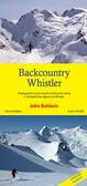 Back Country Whistler map $25.00
 -
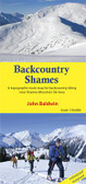 Back Country Shames Map $25.00
 -
-


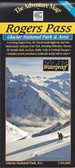
Rogers Pass Back Country Skiing map

Hover over image to zoom
)
Product Description
Printed on waterproof / tearproof paper, this 27” x 38” map is the companion to the GeoBackcountry Rogers Pass Book. Designed in Revelstoke, BC. Printed in Canada. •First Edition •27" x 38" Single-sided folded to 4.25" x 9" •Waterproof | Tearproof •Scale | 1:31,500 •Contour Interval | 20 Metre •Projection | Transverse Mercator •Datum | North American 1983 •Coordinate System | NAD 1983 UTM Zone 11N •100 awesome routes with variations •Parks Canada Winter Parking and Permit Areas •Local place names •Approach trails, huts, foot bridges and more!
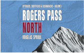
GeoBackcountry Rogers Pass
2nd Edition Rogers Pass Map Text
The 2nd Edition Rogers Pass Uptracks, Bootpacks & Bushwhacks Map for backcountry skiing at Rogers Pass, BC.
The map measures 38” x 27” and folds to 4.25” x 9”. The map scale is 1:42,500.
173 NEW ROUTES for a total of 273 routes.
• Researched, designed and published in Revelstoke, BC. Printed in Canada
• Second Edition
• 38” x 27” Double--sided folded to 4.25” x 9”
• Waterproof | Tear resistant
• Scale | 1:42,500
• Contour Interval | 20 Metre
• Projection | Transverse Mercator
• Datum | North American 1983
• Coordinate System | NAD 1983 UTM Zone 11N
• 173 new routes | Total routes = 273
• High-resolution, illustrated photos
• Parks Canada Winter Parking and Permit Areas
• Parks Canada Regulations and Designated Access Routes
• Local place names
• Approach trails, huts, foot bridges and more!
See geobackcountry web site for map updates/addendums