 Loading... Please wait...
Currency Displayed in

- Home
- Travel Maps
- Columbia Travel Map
Categories
Related Products
-
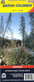 British Columbia Travel Map $10.95
 -
-
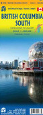
 Columbia Travel Map fb $12.95
 -
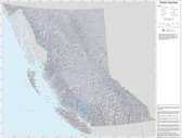 British Columbia Base Map $34.95
 -


Columbia Travel Map
 plus the main natural regions of Colombia.")
Hover over image to zoom
)
Product Description
Folded map of Columbia, South America at a scale of 1:1,400,000 by ITMB
Colombia at 1:1,400,000 on a light, waterproof and tear-resistant, indexed map from ITMB with an enlargement showing the environs of Bogota in greater details, plus large street plans of central Bogota, Medellin and Cartagena annotated with hotels and places of interest. The map divides the country north/south with Bogota included on both sides.
Topography is shown by altitude colouring; national parks and other protected areas are highlighted. Road network indicates unpaved roads, includes selected seasonal tracks and shows driving distances on main routes. Railway lines are included and domestic airports are marked. The map also shows internal administrative boundaries with names of the provinces. Various places of interest are highlighted including cultural and natural World Heritage Sites. Latitude and longitude lines are drawn at 2°30’ intervals and each side has a separate index.
Large, clear street plans present central Bogota, Medellin and Cartagena, showing locations of several hotels, various facilities and places of interest. Also included are maps showing in greater detail the environs of the capital (1:700,000) plus the main natural regions of Colombia.