Loading... Please wait...

Categories

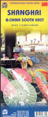
China itmb Travel Map

Hover over image to zoom

  • Large double-sided map of China including Taiwan, with Hai Nam in an inset. Elevation tinting in pastel shades shows the general relief, and selected mountain peak altitudes are marked. The map shows China's provincial boundaries, and symbols for cities classify them according to population size. Road detail distinguishes, expressways, state highways and provincial highways and includes some lower order connecting routes. Intermediate driving distances are indicated on many routes. Main railways and the Great Wall are included and symbols depict ports, airports, passes, locations of interest, ruins, nature reserves and forest parks. Other detail includes swamps, sand expanses, glaciers, salt water lakes, salt pans and the Great Wall. Latitude and longitude lines are drawn at 2 degree intervals. Coverage divides the country into east a west sections with a generous overlap.

All text is in roman script only.The map includes an index of place names. A plan of central Beijing is provided in an inset. This is not indexed but indicates many landmarks, sites of interest and tourist facilities eg. hospitals, the tourist information office, places of worship and selected hotels.
ITMB
$12.95
SKU:
IT291552
Weight:
0.20 KGS

 Product Description

China Travel Reference Map 7th Ed. 2016 1:3,800,000 on waterproof paper 

China is the third largest country on earth and is changing rapidly from a 'peasant' society into an urban society of growing sophistication. This country must be the Number 1 travel destination in Asia. Culturally significant, developing rapidly, open to Tourism as never before, China is a very difficult country to map. We do so every two years, to bring recent changes into perpective. This edition is very timely, in that many of the massive highway-building exercises have been completed. 

The map also includes good inset maps of the three largest cities - Beijing, Shangai, and Guangzou. 

Map size: 27*39"

Large double-sided map of China including Taiwan, with Hai Nam in an inset. Elevation tinting in pastel shades shows the general relief, and selected mountain peak altitudes are marked. The map shows China's provincial boundaries, and symbols for cities classify them according to population size. Road detail distinguishes, expressways, state highways and provincial highways and includes some lower order connecting routes. Intermediate driving distances are indicated on many routes. Main railways and the Great Wall are included and symbols depict ports, airports, passes, locations of interest, ruins, nature reserves and forest parks. Other detail includes swamps, sand expanses, glaciers, salt water lakes, salt pans and the Great Wall. Latitude and longitude lines are drawn at 2 degree intervals. Coverage divides the country into east a west sections with a generous overlap.

All text is in roman script only.The map includes an index of place names. A plan of central Beijing is provided in an inset. This is not indexed but indicates many landmarks, sites of interest and tourist facilities eg. hospitals, the tourist information office, places of worship and selected hotels.

 Find Similar Products by Category

You Recently Viewed...


newsletter

Copyright 2024 GoTrekkers. All Rights Reserved.
 Sitemap | Ecommerce Website Design by High Country Web Design.