Loading... Please wait...

Categories

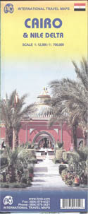
Cairo and Nile Delta Travel Map

Hover over image to zoom

  • Double-sided map from ITMB combining a street plan of Cairo (1:12,500) with, contrary to its title, coverage of the Nile Valley extending south to Luxor (1:700,000). Clear, indexed street plan of the capital covers its inner districts, highlighting areas of particular interest to visitors, including Citadel and Mohammad Ali Mosque, Old Cairo with its Coptic churches, Islamic Cairo with the Han al-Halili Bazaar, etc. 

Metro and railway stations and stops of the river bus on the Nile are prominently marked. Overprint highlights locations of numerous mosques and other religious establishments, museums and public buildings, markets, embassies, etc. The plan is indexed. 

An inset covers the environs of Cairo including access to the city’s international airport and to Giza, and a detailed plan shows the pyramids and other surrounding monuments. Also included is a diagram of the city’s metro lines. 

On the reverse is an indexed map at 1:700,000 of the Nile Valley from Luxor to the Delta, showing road and rail connections along the river and to the Gulf of Suez and Sinai and indicating locations of various archeological sites and other places of interest. Coverage along the Mediterranean coast extends west to include El Alamein, showing road access both from Cairo and Alexandria. The map indicates local administrative boundaries with names of the provinces and has a grid with latitude and longitude at intervals of 1º.
ITMB
$9.95
SKU:
IT6258
Weight:
0.20 KGS

 Product Description

ITMB map of Cairo City & the Nile Delta scale 1;12,5000 & 1;700,000

Double-sided map from ITMB combining a street plan of Cairo (1:12,500) with, contrary to its title, coverage of the Nile Valley extending south to Luxor (1:700,000). Clear, indexed street plan of the capital covers its inner districts, highlighting areas of particular interest to visitors, including Citadel and Mohammad Ali Mosque, Old Cairo with its Coptic churches, Islamic Cairo with the Han al-Halili Bazaar, etc. 

Metro and railway stations and stops of the river bus on the Nile are prominently marked. Overprint highlights locations of numerous mosques and other religious establishments, museums and public buildings, markets, embassies, etc. The plan is indexed. 

An inset covers the environs of Cairo including access to the city’s international airport and to Giza, and a detailed plan shows the pyramids and other surrounding monuments. Also included is a diagram of the city’s metro lines. 

On the reverse is an indexed map at 1:700,000 of the Nile Valley from Luxor to the Delta, showing road and rail connections along the river and to the Gulf of Suez and Sinai and indicating locations of various archeological sites and other places of interest. Coverage along the Mediterranean coast extends west to include El Alamein, showing road access both from Cairo and Alexandria. The map indicates local administrative boundaries with names of the provinces and has a grid with latitude and longitude at intervals of 1º.

 Find Similar Products by Category

You Recently Viewed...


newsletter

Copyright 2024 GoTrekkers. All Rights Reserved.
 Sitemap | Ecommerce Website Design by High Country Web Design.