 Loading... Please wait...
Currency Displayed in

- Home
- Travel Maps
- Brazil Travel Map
Categories
Related Products
-
-
 Bolivia Map Travel Map $12.95
 -
-
-
 Brazil Brasil Travel Map $13.95

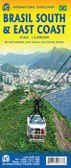
Brazil Travel Map
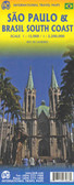
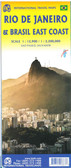
, São Paulo, Brasília and Belo Horizonte, Recife, Belém, Manaus, Salvador and Fortaleza.")
Hover over image to zoom
)
Product Description
Double sided Travel map of Brazil at 1:2,000,000 & 1:3,000,000 with index. Small inserts of Belem, Belo Horizonte, Recife, Sao Paulo, Fortaleza, Salvador, Manaus, Brasilia, Rio De Janeiro - centre, Rio De Janeiro - Copacabana.
Brazil on a large, double-sided map, cleverly dividing the country to cover the more visited eastern part at 1:2,000,000. Street plans are provided for nine cities, including Rio, São Paulo, Brasília and Belo Horizonte.
On one side is the eastern part of the country at 1:2,000,000, extending westwards to beyond São Paulo and Brasília and covering an area from Rio de Janeiro and São Paulo in the south to Belém in the north. The southernmost tip of the country with northern Uruguay is shown on the reverse at the same scale. The remaining part of the country, the Amazon Basin and the Mato Grosso Plateau are shown on the reverse at 1:3,000,000 with the adjoining areas of the neighbouring countries, including northern Bolivia and Peru around Cuzco.
Topography is shown by very effective relief shading, with names of mountain ranges and spot heights. Numerous tributaries of the Amazon and many other rivers are named, and the map also shows seasonal rivers and marshes on the Mato Grosso. National parks and other protected areas are prominently marked.
The map shows Brazil’s road and rail networks, indicating driving distances on main and many secondary routes, and shows locations of local airfields in the more remote parts of the country. Symbols highlight various places of interest, including numerous beaches. Latitude and longitude grid is at 1º intervals. Multilingual map legend includes English. The index is in a separate booklet attached to the map cover.
Also included are plans of the central part of Rio de Janeiro (city centre plus the Copacabana area), São Paulo, Brasília and Belo Horizonte, Recife, Belém, Manaus, Salvador and Fortaleza.