 Loading... Please wait...
Currency Displayed in

- Home
- Travel Maps
- Bay of Naples Capri Travel Map
Categories
Related Products
-
 Victoria Map Travel Map $14.95
 -
 New Zealand Map Travel Map $14.95
 -

-
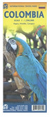 Columbia Travel Map $12.95
 -
 Bolivia Map Travel Map $12.95

Bay of Naples Capri Travel Map

Hover over image to zoom
)
Product Description
Freytag double-sided, folded road and leisure map of the Bay of Naples at 1:50,000, Ischia at 1:20,000, Capri at 1:20,000 & Amalfitana at 1:50,000 with Hiking paths, Tourist information, colour photos and city maps. City inset maps are for Amalfi (7"x6"), Capri (6"x6"), Ischia Ponte (5"x13"), Pompeii (8"x5"), Sorrento (8"x9") and Napoli City (10"x6"). Great quality map to buy for your travels to the Bay of Naples, Capri, Ischia and Amalfitana, Italy.
Gulf of Naples and its islands on a detailed road map at 1:50,000 from Freytag & Berndt, with Capri and Ischia at 1:20,000, street plans of central Naples, Sorrento and Amalfi and a plan of the archaeological site at Pompeii.
The main map covers the whole of the Gulf area, extending east to Nocera and south beyond Amalfi to include the whole of the Sorrento Peninsula and most of Monti Lattari. Ischia with Procida is shown as an inset. The map shows the area’s road network, highlighting scenic routes, and includes several hiking paths on the northern slopes of Vesuvius and in the mountain of the Sorrento Peninsula. Local ferry connections are also marked.
Icons highlight various places of interest, including the archaeological sites at Pompeii and Herculaneum, campsites, beaches, marinas, castles and monasteries, etc. Along the slopes of Vesuvius lava flows show dates of various eruptions. Margin ticks give latitude at 12' intervals with longitude at 5'. Map legend includes English.
On the reverse, Capri and Ischia are shown enlarged to 1:20,000 for clearer presentation but without additional detail. Street plans cover central Naples, Sorrento, Amalfi and the towns of Capri and Ponte on Ischia. Also included is a detailed map of Pompeii highlighting various Roman remains.