 Loading... Please wait...
Currency Displayed in

- Home
- Travel Maps
- Austria Travel Map
Categories
Related Products
-
-
 Victoria Map Travel Map $14.95
 -

-
 Bolivia Map Travel Map $12.95
 -
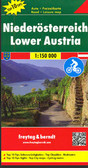 Lower Austria Travel Map $13.95

Austria Travel Map

Hover over image to zoom
)
Product Description
Freytag double-sided, folded road map of Austria at 1:500,000 with tourist information, comprehensive culture guide & index with postal codes. Great quality travel map to buy for your trip to Austria.
Austria at 1:300,000 on a large, double-sided, very detailed road map from Freytag & Berndt with very good presentation of the country’s topography, plus an index booklet with town centre street plans of 10 main cities.
The map is double-sided, with no overlap between the sides. Coverage includes the German Alps with much of Bavaria, and in the south Italian Tyrol with the Dolomites. Excellent relief shading presents the topography, with plenty of names of individual mountain ranges, valleys, peaks, etc. Finely graded presentation of the road network indicates driving distances on many small local roads, three types of gradient markings, roads closed to motorized traffic or caravans or not suitable for caravans, and toll routes. Scenic roads are highlighted and special tourist routes are named. Railway lines are shown with stations and various types of mountain transport are marked. Picturesque towns and villages are highlighted and symbols mark locations of various places of interest including campsites and youth hostels. The map has latitude and longitude lines at intervals of 10’. Multilingual map legend includes English.
Index booklet, listing all locations with postcodes, also provides city centre street plans of Bregenz, Eisenstadt, Graz, Innsbruck, Klagenfurt, Linz, Salzburg, St. Pölten and Vienna.