 Loading... Please wait...
Currency Displayed in

- Home
- Travel Maps
- Albania Travel Map
Categories
Related Products
-
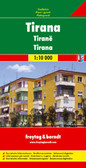 Tirana Albania Travel Map $11.95
 -
 Victoria Map Travel Map $14.95
 -

-
 Albania itmb Travel Map $11.95
 -
 Bolivia Map Travel Map $12.95

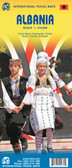
Albania Travel Map
. The map has latitude and longitude lines at intervals of 30’. The index is on the reverse. Map legend includes English.")
Hover over image to zoom
)
Product Description
Freytag folded road map of Albania at 1:400,000 with tourist information, index with postal codes & distances in km. Best quality travel map that you can buy for your trip to Albania.
In addition to the clear layout, the road map "Albania 1: 400,000" has numerous additional information such as road conditions, sights and campsites.
In addition, the extensive location register allows quick orientation.
Tourist information, town register with postcodes, distances in km;
Albania at 1:400,000 on an indexed road map from Freytag & Berndt, with coverage also including the whole of Montenegro and Kosovo, large part of Macedonia, and within Greece extending south to Ioannina and Trikala.
Topography is shown by relief shading with colouring for woodlands and names of mountain ranges. National park and other protected areas are highlighted. Road network gives driving distances on many local routes and shows border crossings. Railway lines are included, also local airports and ferry ports on the Adriatic. Symbols highlight various places of interest including campsites, golf courses, etc. Within Kosovo most location are shown with dual place names (Albanian and Serbian). The map has latitude and longitude lines at intervals of 30’. The index is on the reverse. Map legend includes English.